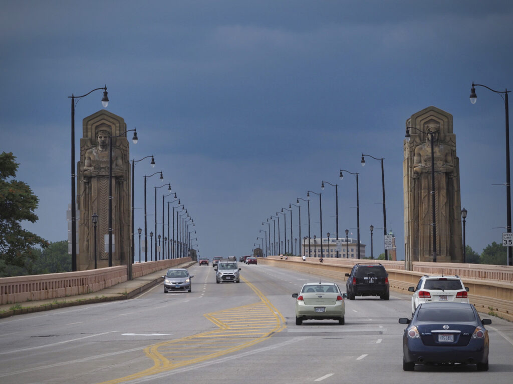
Cleveland’s Memorial Bridges Loop is intended to close a downtown walking and bicycling gap along Huron Road and Ontario Street. The improvements connect existing facilities at the Detroit-Superior and Lorain-Carnegie bridges, helping complete a roughly three-mile loop through downtown and West 25th Street. ODOT’s project listing identifies the work as a shared-use path project.
The City lists November 2026 as the expected completion month. That schedule does not confirm that every segment is open. Before visiting, check the City’s project page and follow current signs and barriers. The official materials reviewed for this article did not establish a full-route opening date. For people walking, using wheelchairs, running, or cycling, the important questions are where the path connects, how crossings change, and which temporary arrangements remain in place.
Call (216) 677-5490 or request a free consultation to speak with a dedicated local Cleveland auto accident attorney at Buckeye Law Group today.
Where Does the Memorial Bridges Loop Go?
The loop connects the Detroit-Superior Bridge, also known as the Veterans Memorial Bridge, with the Lorain-Carnegie Bridge, commonly called the Hope Memorial Bridge. West 25th Street connects the bridge approaches on the west side of the Cuyahoga River; Huron and Ontario provide the downtown connection.
The new work fills a missing link between existing bridge facilities. It does not mean Cleveland is constructing three miles of entirely new trail. ODOT describes the Huron and Ontario improvements as completing the larger loop.
When planning a trip, distinguish a project map from an access map. A drawing showing the finished connection does not establish that a particular crossing, curb ramp, or path entrance is available that day.
What Improvements Are Planned for Huron and Ontario?
An October 2025 public presentation hosted by Cleveland Metroparks describes three principal improvements:
| Location | Published Design | Practical Significance |
|---|---|---|
| Huron Road | Replace a vehicle lane with a 10-foot shared-use path and a five-foot delineated buffer; add a high-visibility crossing with a rectangular rapid-flashing beacon at the Tower City entrance. | Creates designated walking and cycling space and highlights a crossing point. |
| Huron–Ontario Intersection | Improve the crosswalk and reconstruct the slip-lane island. | Changes how people navigate the turning lane and intersection. |
| Ontario Street | Widen the existing sidewalk to approximately 14.5–19.5 feet, connecting with the shared-use path at the Hope Memorial Bridge plaza. | Provides more room for shared use near the bridge approach. |
These are published design descriptions, not a field inspection of completed construction. Final dimensions, operating signals, and available entrances should be confirmed after completion. “Shared-use” also matters: walkers and cyclists may occupy the same facility. Separation from motor traffic does not eliminate interactions between path users or conflicts at driveways and intersections.
Why Is Cleveland Making These Changes?
The City identifies this corridor as a gap in its pedestrian and bicycle network. Its project page reports 132 crashes, two deaths, and two serious injuries between 2021 and 2025 on Huron and Ontario between Superior and Carnegie avenues. Those figures describe the specified corridor and period. They are not a count of pedestrian or bicycle crashes alone, and they do not establish fault in any individual collision. The improvements aim to strengthen connections and address safety concerns. Whether they reduce crashes will require evaluation after opening; a planned improvement is not proof of a measured safety result.
What Should Travelers Expect During Construction?
The City’s June 18, 2026 construction notice announced restrictions beginning June 22 and continuing through mid-November:
- Eastbound Huron between Detroit Avenue and Ontario: One through lane, with additional turn lanes at intersections.
- Southbound Ontario between Huron and Carnegie: One lane.
- Eastbound Detroit at Huron: One left-turn lane and one combined through/right-turn lane, with the bicycle lane merging into vehicle traffic through the intersection.
- Possible parking restrictions on the north side of Huron between West 3rd Street and Superior.
Treat these as the announced construction arrangements, not confirmation of today’s exact layout. ODOT administers construction, and restrictions can change as work progresses. Allow extra time and identify an alternative before reaching a closure. Never assume a newly paved surface is open while barriers remain. If a pedestrian detour is unclear or inaccessible, seek a marked alternative instead of entering the work area.
Practical Guidance for Walking and Cycling
At Crossings: Follow the controls that apply to your movement. Before proceeding, check for turning vehicles and traffic approaching from each relevant direction. A flashing warning device should not be treated as confirmation that every driver has stopped.
On Shared Sections: Ride at a speed that leaves time to respond to someone stopping or changing direction. Give an audible warning before passing, leave comfortable clearance, and wait when the available space is narrow.
At Transitions: Look ahead for the point where a path becomes a crossing or where temporary arrangements place bicycles in traffic. Drivers should anticipate people entering these transitions and avoid crowding them.
For Accessibility: Before a longer outing, confirm that the intended route has usable curb ramps and a continuous passage. If reporting a blockage, identify the nearest intersection, side of the street, and whether a wheelchair or stroller can pass. These details help explain the actual access problem. These precautions support trip planning. They do not determine who is legally responsible if an injury occurs.
Ohio Traffic Rules Relevant to the Corridor
Under Ohio Revised Code § 4511.46, when traffic signals are absent, inoperative, or not clearly assigning right-of-way, drivers must yield to pedestrians within a crosswalk under the statute’s specified conditions. Pedestrians may not suddenly enter the path of a vehicle close enough to create an immediate hazard. Drivers also may not pass a vehicle stopped at a crosswalk to let someone cross.
For cyclists using the roadway, ORC § 4511.55 does not require riding at the edge when doing so is unreasonable or unsafe, including where hazards or a narrow lane make that position unsafe. ORC § 4511.27 identifies three feet or more as a safe passing distance when a motor vehicle overtakes a bicycle.
What to Document After an Injury
Call 911 when emergency assistance is needed and prioritize medical care. When safe, preserve:
- The exact location, time, travel direction, and witness contact information.
- Photographs of vehicles, path transitions, signs, barriers, signals, and surface conditions.
- Original video files and information identifying nearby cameras.
- The police report number, medical records, damaged equipment, and related expenses.
Construction layouts can change quickly, so photographs showing the wider scene may be particularly useful. Do not enter traffic or a closed work area to obtain them. Ohio Revised Code § 2305.10 generally provides two years after a bodily-injury claim accrues to file suit, but exceptions and other rules may affect a particular claim. Seek individualized advice rather than calculating a deadline from this article.
Cleveland Resources for Route Questions and Hazards
- Project Information: The City’s Memorial Bridges Loop page provides the overview, schedule, and links to plans.
- Construction Questions: ODOT’s project listing identifies District 12 public information: 216-584-2005 and D12.Public.Information@dot.ohio.gov.
- Non-Emergency Street Issues: Use Cleveland 311, call 311, or call 216-664-2000. Describe the obstruction and location precisely.
- Emergencies: Call 911 for urgent police, fire, or medical assistance.
Preguntas frecuentes
- Is the entire loop newly constructed? No. The project adds the Huron and Ontario connection to existing facilities associated with the two bridges and West 25th Street.
- Is the completed route officially open? The City’s schedule targets November 2026. The sources reviewed did not confirm full opening; check current notices and on-site controls.
- Is the path only for bicycles? No. It is described as a shared-use facility for walking, running, and bicycling. Expect different speeds and leave room for others.
- Will the path eliminate traffic crossings? No. The design includes crossing improvements. Users should continue to follow intersection controls and account for turning vehicles.
Planning a More Informed Trip Through Downtown Cleveland
Check route access before leaving, allow time for detours, and report specific hazards. After an injury, Buckeye Law Group’s Cleveland pedestrian injury attorneys and bicycle accident attorneys can review potential claims and available evidence through a free consultation.
Call (216) 677-5490 or request a free consultation today to speak with a dedicated local Cleveland auto accident attorney at Buckeye Law Group.
Legal Disclaimer: This article provides general educational information about Cleveland’s Memorial Bridges Loop and Ohio injury law as of November 11, 2026. It is not individualized legal, medical, or transportation advice and does not create an attorney-client relationship. Construction schedules and access may change. Claims, coverage, and deadlines depend on individual circumstances. No outcome is guaranteed.