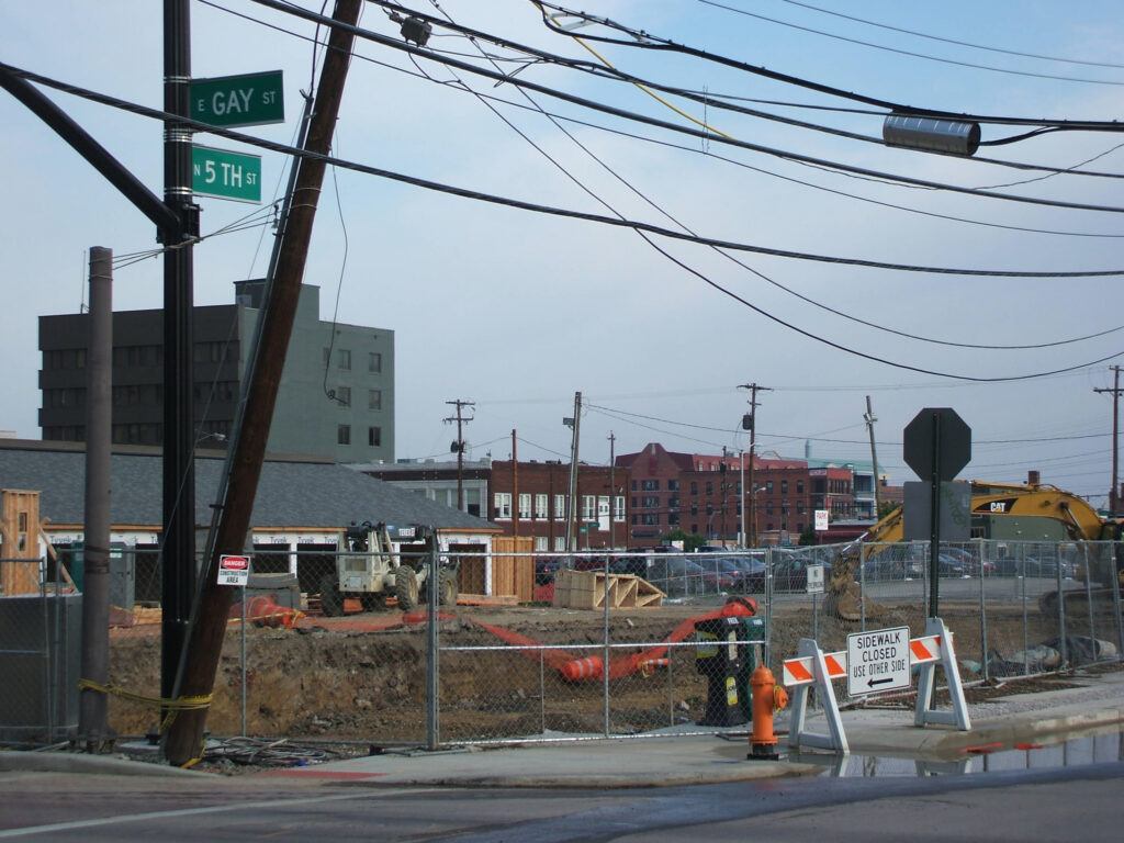
Capital Line construction is changing access along Gay Street in Downtown Columbus. Drivers face vehicle restrictions and parking changes, while pedestrians and cyclists must navigate shifting pathways and work zones. This guide covers the published November 2026 schedule, safety considerations, and local contacts. Verify current conditions before traveling because closures may change.
Call (614) 482-3793 or request a free consultation today to speak with an experienced Columbus pedestrian and car accident attorney at Buckeye Law Group.
What Is the Columbus Capital Line?
The Capital Line is a planned two-mile walking and biking pathway across Downtown Columbus, including Gay, Fourth, and Rich Streets and connections toward the Scioto Peninsula. The Columbus Capital Line project also includes streetscape improvements, such as roadway paving and upgraded lighting, intended to enhance accessibility, infrastructure, and the overall pedestrian experience in downtown Columbus. Construction along Gay Street began in April 2026 with utility work and roadway modifications, with improvements progressing block by block to accommodate different phases of the project. As construction continues, residents, commuters, business owners, and visitors should anticipate potential changes to traffic patterns, pedestrian access, and surrounding roadway conditions. Downtown Columbus, Inc. publishes construction schedules and project updates to help the public monitor ongoing improvements, identify anticipated closures or detours, and make informed travel decisions when navigating downtown Columbus.
Which Parts of Gay Street Are Closed in November 2026?
As of November 16, 2026, the project website identifies the Front Street–High Street block as closed to vehicle traffic during block-by-block reconstruction. Work began there August 3, with the published phase scheduled through December 16, 2026. Pedestrian access to buildings is being maintained through designated walkways. The published schedule identifies the next stages as follows:
- High Street to Pearl Street: Preparatory activity in November 2026, with block reconstruction scheduled from November 2026 through March 2027.
- Pearl Street to Third Street: Block reconstruction planned for March–July 2027.
- Third Street to Fourth Street: Block reconstruction planned for July–November 2027.
The project also lists High Street intersection reconstruction in the November–December 2026 period. Nearby, North Pearl Street between Elm and Gay Streets has been designated closed to vehicle access through December 2026 while pedestrian access is maintained.
Construction schedules and anticipated completion dates are subject to change and should not be interpreted as guaranteed roadway closure or reopening times. Additionally, a scheduled future construction date does not necessarily indicate that a particular street or block is currently closed or inaccessible. Motorists, pedestrians, and cyclists traveling through downtown Columbus should remain attentive to posted construction signs, temporary traffic control devices, designated detours, and changes in roadway or sidewalk access. Before traveling through affected areas, individuals are encouraged to consult the official Columbus Capital Line project updates for the latest available information about construction progress, anticipated street closures, traffic restrictions, and temporary pedestrian or bicycle routes. Reviewing these updates alongside on-site signage can help travelers plan alternative routes, anticipate potential delays, and navigate active construction areas more safely.
How Will Parking, Deliveries, and Business Access Work?
The project team says businesses remain accessible on foot through temporary walkways, ramps, and bridges where necessary. Along the block between Front Street and High Street, pedestrians should follow the clearly marked walkway adjacent to building fronts. Pay attention to posted construction signs, temporary pedestrian detours, and changes in sidewalk access to help navigate the area safely. On-street parking was removed from Gay Street between Front and Fourth Streets. Temporary loading zones support deliveries and pickups, generally for 15 minutes or less. Check the current loading-zone map before arriving.
The Fourth & Elm Garage at 78 N. Fourth Street offers a project-related validation program for participating Gay Street businesses. Its advertised $1-per-hour rate, up to three hours, requires a business validation. Confirm eligibility and current terms before parking.
Safety Considerations for Drivers Near Gay Street
Allow extra travel time and follow posted detours rather than relying exclusively on navigation apps, which may miss temporary restrictions. Near High Street, Third Street, and alley entrances, watch for temporary pedestrian crossings, loading vehicles, and construction equipment. Adjust speed, leave appropriate stopping distance, and keep crosswalks clear. For pickups or deliveries, locate a permitted loading zone in advance. Avoid stopping beside barricades or reversing unexpectedly into pedestrian travel paths.
What Pedestrians Should Know About Temporary Walkways
The October 29 project update reported that pedestrian access between Front and Wall Streets had shifted to the north side of Gay Street while the south side was closed. Follow marked walkways, signals, and flaggers. Avoid fenced excavation areas and watch for uneven surfaces, temporary ramps, garage exits, and equipment near entrances.
Temporary pedestrian routes and changes in sidewalk elevations may create additional challenges for wheelchair users, individuals using walkers or other mobility aids, and families with strollers. Project plans call for accessible ramps and temporary pedestrian bridges where necessary to help maintain access during construction. Pedestrians should follow designated accessible routes and remain attentive to uneven surfaces, temporary barriers, and changes in walkway conditions. If an accessible route is blocked, difficult to navigate, or presents a potential safety concern, report the issue to the project team or Columbus 311 so the condition can be reviewed and addressed.
What Cyclists Should Know During Construction
During construction, cyclists should not assume that the future Columbus Capital Line is open or accessible as a continuous bicycle route. Temporary walkways designated for pedestrian access may restrict bicycle riding, making it important to review posted signs, construction notices, and current bicycle access restrictions before traveling through the area. When bicycle access is limited or prohibited, cyclists should use an alternative route that complies with applicable traffic laws. Riders should also remain alert for construction debris, uneven pavement, temporary barriers, moving construction vehicles, and loading or unloading operations that may create additional hazards. Where signs or authorized construction personnel direct cyclists to dismount, they should walk their bicycles through permitted areas or follow the designated detour.
Ohio Revised Code § 4511.55 generally requires roadway cyclists to follow applicable traffic rules, but it also recognizes that riding near the roadway edge may be unsafe because of obstructions, surface hazards, or narrow lanes. It does not require riders to place themselves in an unsafe position.
How Ohio Traffic and Injury Laws May Apply
Construction does not eliminate roadway responsibilities. Under Ohio Revised Code § 4511.46, drivers generally must yield at crosswalks when traffic signals are absent, inoperative, or not clearly assigning right-of-way, subject to statutory conditions. Pedestrians also have important responsibilities when navigating public roadways, intersections, and construction zones. Understanding and following applicable traffic laws, obeying pedestrian signals, and remaining attentive to surrounding conditions can help reduce the risk of accidents and promote safer travel for everyone sharing the roadway.
A collision near construction does not automatically establish fault. Ohio’s comparative-fault law and ORC § 2315.33, generally permits recovery when a claimant’s fault is 50% or less, with damages reduced by that percentage.
ORC § 2305.10 generally provides a two-year limitations period for bodily-injury claims, with exceptions depending on the circumstances. Potential claims involving a public agency or roadway condition can raise additional immunity and procedural questions; the presence of a work zone alone does not establish liability.
What Should You Do After an Accident Near a Construction Zone?
Following an accident near a construction zone, prioritize your safety by moving away from traffic, construction equipment, or other immediate hazards when it is safe to do so. Call 911 if anyone is injured, emergency assistance is needed, or an immediate danger exists. Seek an appropriate medical evaluation, even if injuries initially appear minor, as certain symptoms may not become noticeable until hours or days after the incident.
When conditions permit, document the accident scene by photographing the specific street or intersection, vehicle damage, traffic control signs, construction barriers, equipment, roadway conditions, and temporary pedestrian or bicycle routes. Record the date, time, and location of the incident, and obtain contact information from potential witnesses without interfering with emergency responders or ongoing construction activities.
Preserve all relevant documentation, including photographs, medical records, insurance correspondence, and available police or crash reports. If unsafe roadway conditions, damaged barriers, or obstructed pedestrian pathways contributed to the incident, consider reporting those hazards to the appropriate local agency, such as Columbus 311. Reporting a hazardous condition can help alert authorities to potential safety concerns, but it does not replace medical care or individualized legal guidance.
Columbus-Area Agencies and Local Construction Resources
Capital Line Project Team, Downtown Columbus, Inc.:
- For active-work questions, access concerns, and loading issues, contact:
- Project Executive Madison Cole at (760) 409-7114
- Project Engineer Alec Schroeder at (614) 935-6093
- The project also lists in-person office hours on Fridays, 9–10 a.m., at Brioso Coffee, 53 N. High Street, subject to location changes.
Columbus Department of Public Service:
- For information about city street conditions, roadway maintenance, traffic safety concerns, or construction-related hazards, residents and motorists can visit the Columbus Department of Public Service official website or call our office to access resources, report issues, and obtain relevant updates:
- Phone: (614) 645-3111
- Address: 111 N. Front Street, Columbus, OH 43215
- Website: Columbus Public Service
Columbus 311 Customer Service Center:
- Report non-emergency sidewalk access problems, damaged street infrastructure, or related city service concerns at:
- Phone: (614) 645-3111
- Email: 311@columbus.gov
- Website: 311 Customer Service Center
Columbus Division of Police:
- Emergencies: 911
- Non-Emergency Police Response: (614) 645-4545
- Address: 120 Marconi Boulevard, Columbus, OH 43215
- Website: See Columbus Police for further information.
Central Ohio Transit Authority (COTA):
- For the latest information about public transportation routes, bus stop locations, temporary stop relocations, and service adjustments resulting from construction or roadway closures, passengers can contact the transit agency directly using the information provided below. Reviewing current service alerts and route updates before traveling can help passengers anticipate delays, identify alternative stops, and plan their trips more effectively:
- Phone: (614) 228-1776
- Address: 33 N. High Street, Columbus, OH 43215
- Website: COTA’s trip planner and alerts
Frequently Asked Questions
- Is Gay Street completely closed during Capital Line construction? No. The project is being constructed in stages. The Front-to-High block is closed to vehicles during its current reconstruction phase, while other blocks have separate schedules and access restrictions. Follow posted traffic signs and construction warnings for the most up-to-date information about roadway conditions, temporary restrictions, and potential safety hazards.
- Can pedestrians still reach Gay Street businesses? The project team states that pedestrian access to buildings will be maintained, although temporary routes may change. Visitors should use designated pathways and request assistance if an accessible route is obstructed.
- When will the Front Street-to-High Street block reopen? The published schedule indicates December 2026, with the current phase listed through December 16. Weather, utility coordination, or field conditions can affect timing, so check for an updated announcement.
- Where can drivers park near Gay Street? Nearby garages remain an option. The Fourth & Elm Garage has a validation program for participating businesses. Check current prices, terms, and pedestrian access before arriving.
- Who should I contact about an unsafe pedestrian detour? For immediate construction-access concerns, contact the Capital Line project team. For non-emergency city sidewalk or street issues, contact Columbus 311. Call 911 for an urgent threat to safety.
Staying Informed as the Capital Line Takes Shape
Because construction conditions evolve, check project updates, street signs, and transit notices before each visit. If you have been injured in a Columbus collision involving a motor vehicle, pedestrian, or cyclist, Buckeye Law Group’s Columbus office can discuss the circumstances during a free consultation. Representation may be available on a contingency-fee basis, subject to a written fee agreement.
Call (614) 482-3793 or request a free consultation today to speak with an experienced Columbus pedestrian and car accident attorney at Buckeye Law Group.
Disclaimer: This article is for general educational and informational purposes, not individualized legal, medical, or transportation advice. Construction conditions and laws may change. Reading this article or contacting Buckeye Law Group does not by itself establish an attorney-client relationship. Every case depends on its facts; no outcome is promised.